Showing posts with label weather. Show all posts

Tuesday, August 23, 2011

I Think The United States Is Under Attack!!!

Under attack by Mother Nature! Seriously. Here is why I believe so:

  • Monday, August 22 at 11:46pm Colorado time, a 5.3 earthquake shook Trinidad Colorado.  The New York Times reported it as the largest natural quake to hit Colorado in more than a century.
  • Tuesday, August 23 at 1:51 eastern time, a 5.9 quake hit Mineral VA and was felt all up and down the East Coast.  We felt that thing here in the Midlands of South Carolina!
  • This map of latest US Quakes has me worried. 
  • There have been 16 US quakes with magnitude greater than 3.0 since yesterday. See here for what I'm talking about. 9 have been in the contiguous US.
  • Right NOW we have this report from USA Today regarding Hurricane Irene.


If you fail to see the logic in my thinking, let me introduce you to some things that may be new to you expound upon my true feelings based on some facts:

  1. These two earthquakes were about 12 hours apart.
  2. They were both rare.
  3. After earthquakes aftershocks are common.
  4. Those 9 quakes plus Irene makes me nervous.
Okay.  After reading all of this, I may have been hasty to have made that comment.  I also may have been desperate to get another blog entry in before the end of the month.  Who knows.  It is hurricane season, but in my mind it is NEVER earthquake season in South Carolina.


Earthquakes strike Virginia, Colorado | MNN - Mother Nature Network

Wednesday, July 6, 2011

Strong Afternoon Thunderstorms

A persistent, juicy south-southwest low level wind  is setting up the State for an afternoon of widespread thunderstorms. As with the past few afternoon events a few isolated cells will be strong to severe with one inch hail, 40-60mph wind gusts and downright scary frequent lightning. Heavy, slow moving cells are ripe to drop 1-2 inches of a mysterious fluid called rain.  Expect better more inclusive coverage of storm cells across the State then the past few afternoons. Best chance for heaviest rain should be in a swath from Allendale/Hampton County to Marlboro/Dillon County. Storm cells begin to pop inland of the Coast after 12 noon and migrate inland. Thunderstorm cells pop Upstate-Midlands-Pee Dee after 2 PM. Heaviest rain and severe threat will be in the daytime heating sweet-spot of 4-7 PM

The high priests of high vorticity at the Storm Prediction Center in sunny Norman Oklahoma have placed the Upstate, Midlands and Pee Dee under a slight risk for severe thunderstorms; no tornadoes.

Tropics? Snooza-poolza.

Wednesday, April 27, 2011

Severe Thunderstorms

Good Morning,

Er, Toto, we might as well be in Kansas… . A very strong low pressure complex to the west heads east leaving a very violent history across Texas, Arkansas, Louisiana. Mississippi and Kentucky. More severe thunderstorms and tornadoes today for Northern Alabama, Georgia and Tennessee. Timing and dynamics, however, are in our favor…. again. The Storm Prediction Center in tornado-wise Oklahoma has a large HIGH-MODERATE probability bulls-eye to the west of us and only a slight chance for severe for the State today valid until tomorrow morning. Best ingredients for widespread severe weather outbreaks translate northeast into NC and VA.

Expect afternoon non-frontal airmass thunderstorms to develop this afternoon in the warm soupy air in place (think bucket of gasoline and toaster…). Isolated cells will be severe with 50-70 mph wind gusts, large hail, heavy rain and frequent lightning. Charming. This activity de-energizes near sunset.

The cold front to the west approaches the Upstate tonight with pre-frontal thunderstorms around midnight. The front enters the Upstate in the dark  near 2-3 AM, Midlands 05-08 AM with strong shear but diminishing  convective available potential energy. Isolated embedded strong to severe thunderstorm with damaging wind gusts to 70 mph, hail and an isolated tornado are fair game, although not with the swarm of tornadoes seen to the west. Models are showing the front slowing as it closes the coast late Thursday, re-strengthening to severe storms over the beaches on max afternoon heating.

33 shopping days until hurricane season.

Today’s forecast cartoon:


The Storm Prediction Center’s Severe Thunderstorm and Tornado Outlook for Today:


Thursday, February 3, 2011

Upstate Almost Winter Weather

Dear Winter,
This is an email I received today from WEATHERALERT.  As I said in my previous note to you, YOU SUCK!

Thanks and have a Great Day,
Keala M Jacobs

"Attempting to find short-term fixes that address the symptoms of the crisis only ensures the organization will wind up back in the same predicament."  ~~Alan Murray

From: Mark Malsick On Behalf Of WEATHERALERT
Sent: Thursday, February 03, 2011 8:13 AM
To: WEATHERALERT
Subject: Upstate Almost Winter Weather

Good Morning,

A developing surface low pressure in the central GoMex will turn on the faucet for a lengthy rainfall event starting… er, now. For most of the State this means rain, at times heavy (two-by-two rain…), tonight and all day Friday. Rain clears out before lunch Saturday.  The Upstate Quixotic wrinkle in this forecast is that from the northern Midlands and Upstate, expect periods of sleet and freezing rain Friday morning and again Friday night. Morning low temperatures will be 32 degrees along the I-85 corridor. Change over to plain rain Friday will be quick after 8 AM. Do not see any significant accumulation. Sledding: Poor.

Friday morning’s forecast cartoon courtesy NOAA/HPC:


Mark Malsick
Severe Weather Liaison
South Carolina Department of Natural Resources
State Climate Office
1000 Assembly Street Columbia, SC 29202


Tuesday, February 1, 2011

Dear Winter

Dear Winter,
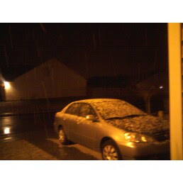
You SUCK!  You were in rare form this season.  You started out by making us think you were a little late by imitating Autumn.  The only problem with that is that Autumn didn't stay long once you decided to make your GRAND entrance.  That's because you were so daggone COLD when you got here.  Then you decided to bring snow and ice to the entire United States except for Florida!  How dare you?  You made my kids miss an entire week of school and they're going to have to make it up.  Winter, YOU SUCK!

Oh, but that's the half of it WINTER.  You dressed up like Spring this weekend just to tease us.  Really?!?!  What was that about?  I enjoyed the Sunshine, blue skies, and above 60 degree temperature.  Why did you take that outfit off?  As soon as Monday got here, you started wearing grey skies and being chilly again.  You even had the nerve to RAIN on us. You know we are ready for you to leave because we love Spring so much.  That's why you dressed up like Spring.  You jealous of Spring or something?

All of this grayness and water you have today is just YUCK.  Well, tomorrow is Groundhog Day.  I hope that Groundhog predicts that you will be gone sooner than normal.  You have worn out your welcome.  I'm so sick of you.  I want you to leave.  Please go away and don't come back until December 2011.
Thank you and God Bless you.
Keala

Tuesday, January 15, 2008

NOT

I did NOT walk for 30 minutes last night.

When I got home it was COLD, dark, and late.

When I woke up this morning it was COLD, dark, and way too early.

Ewww. I hate this weather.

I could go to the gym and walk for 30 minutes on the treadmill. That would work!

Related Posts with 

Thumbnails